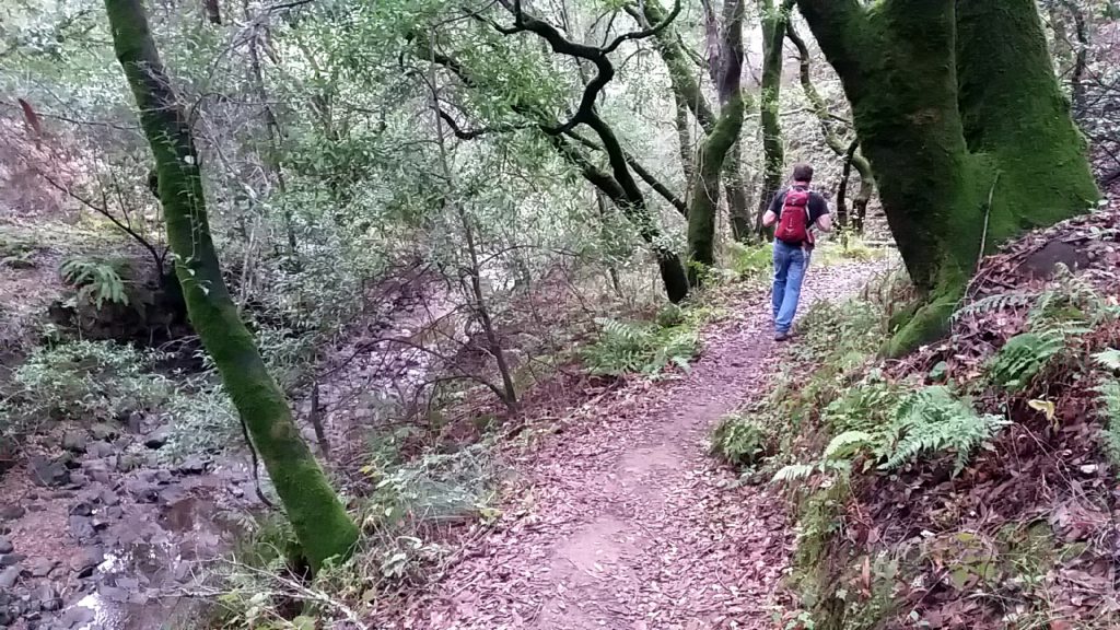
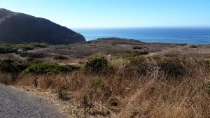
Combination motorcycle ride and hike today. Road a couple of the 3 Bears, turned around at San Pablo and went to the Briones Pine Tree trailhead off Alhambra Valley Road. This was my first time entering Briones from this location. Very pleasant day!
Great view of a hawk that flew directly over my head as I was heading back. I was side hilling on slope above Alhambra Valley and he came down from above then immediately caught an uplift of the valley wind and effortless rose at least 40 feet in a second or two. It was something to watch!.
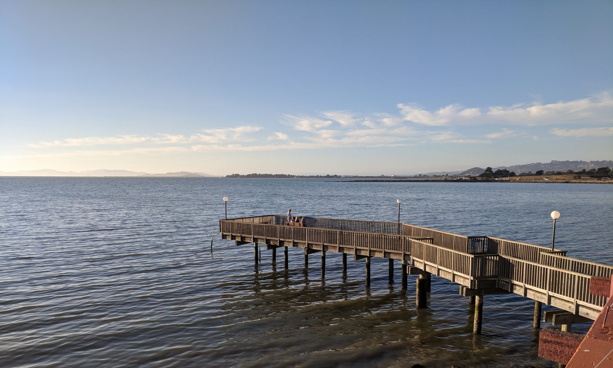
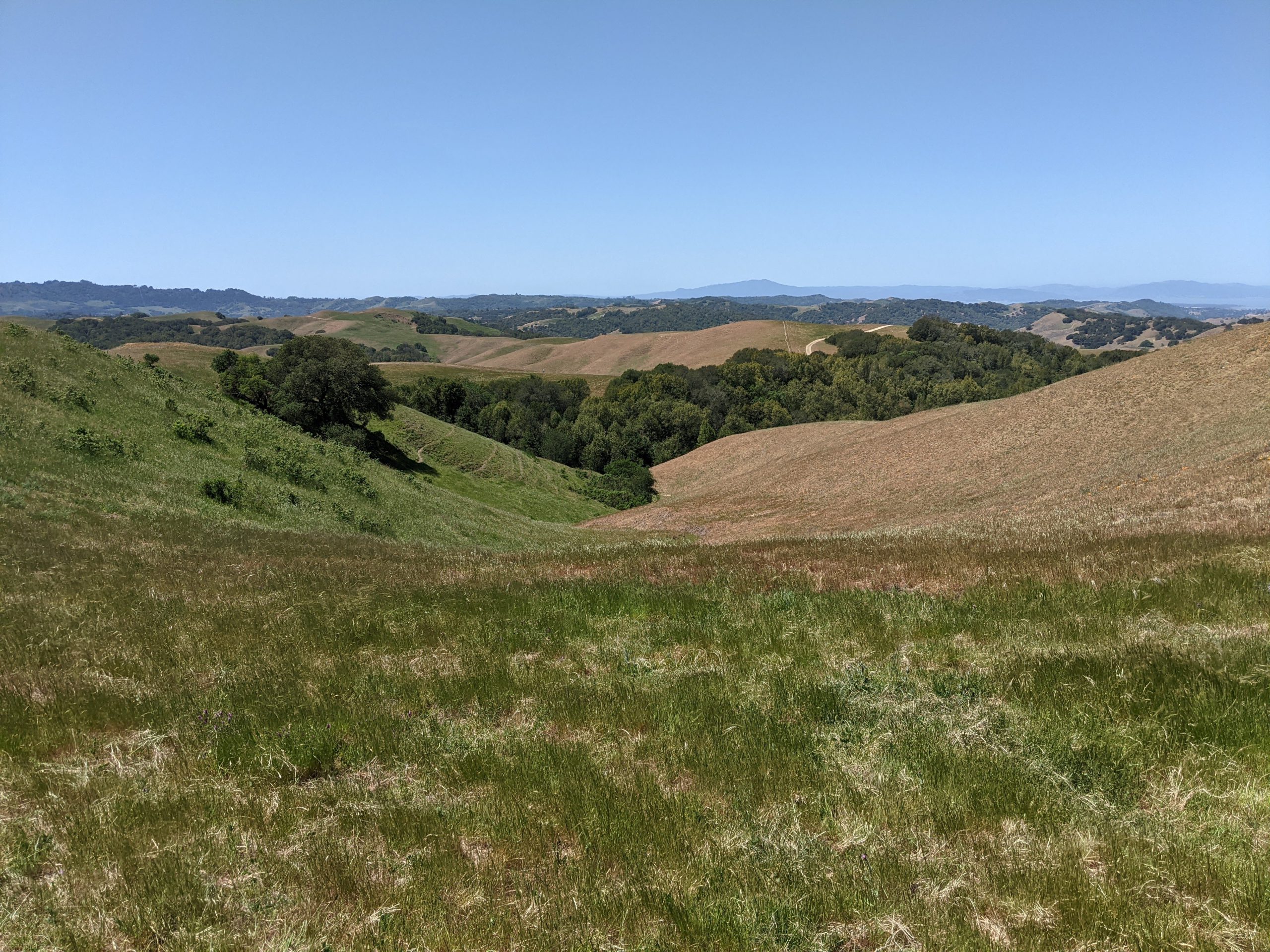
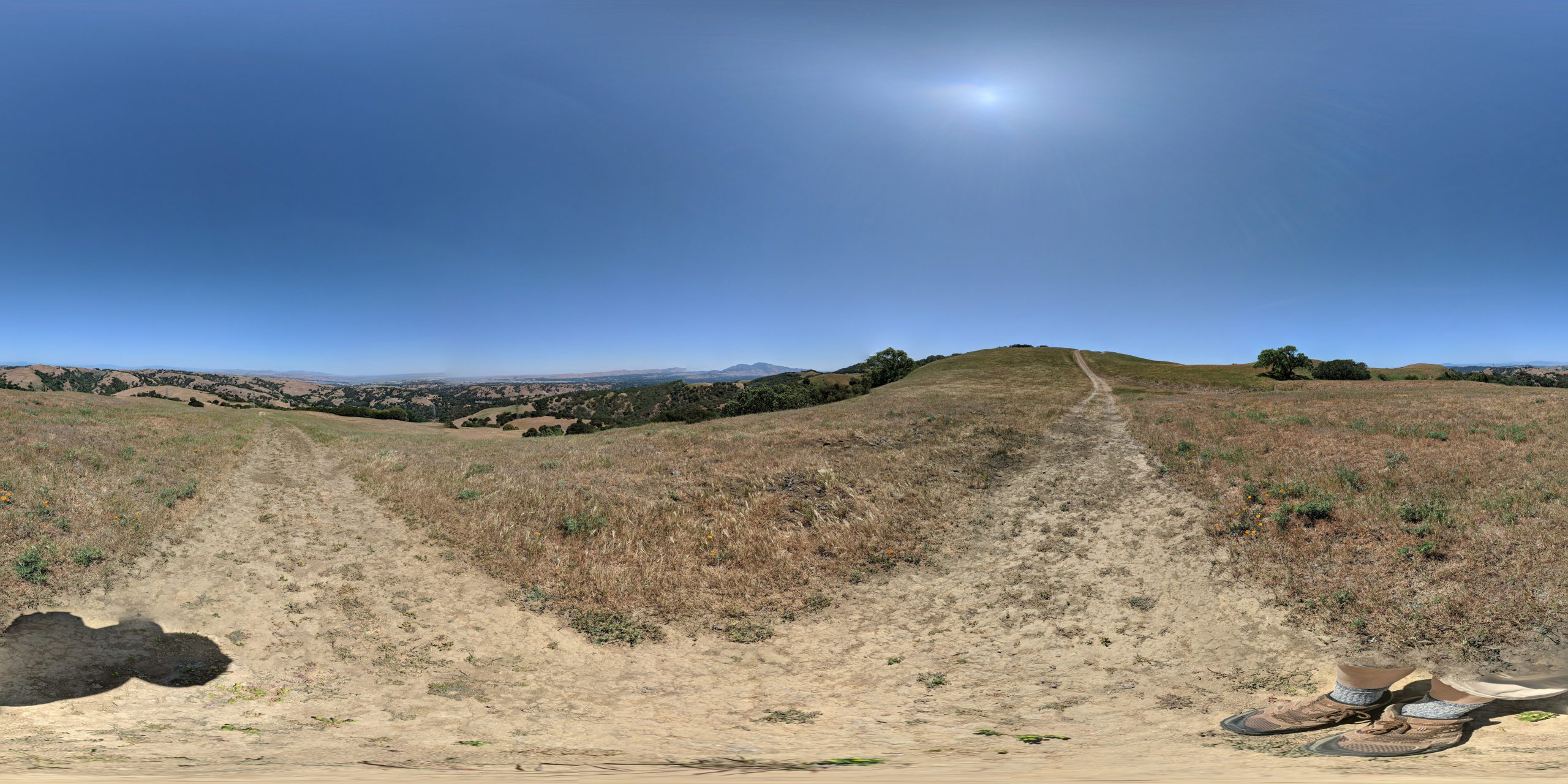
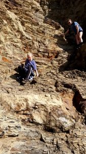
Bob and I completed the next section of the BART today. A 8+ mile segment with a fantastic view spot on “Dinosaur Ridge”. The Vista is comprised of a hard fossilisiferous material that contains the most embedded seasheells that I have seen in a very long time. I took a photoshpere but unfortunately my camera is acting up and it did not save.
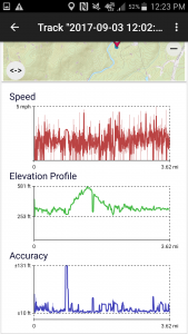
A fairly strenuous hike with over 7000′ of total elevation gain. But some great views and the few people we saw were quite nice.
Total distance: 8.42 mi Max elevation: 1063 ft Min elevation: 95 ft Total climbing: 7162 ft Total descent: -7231 ft
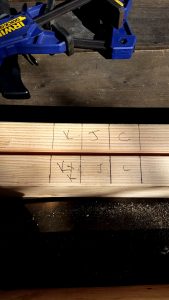
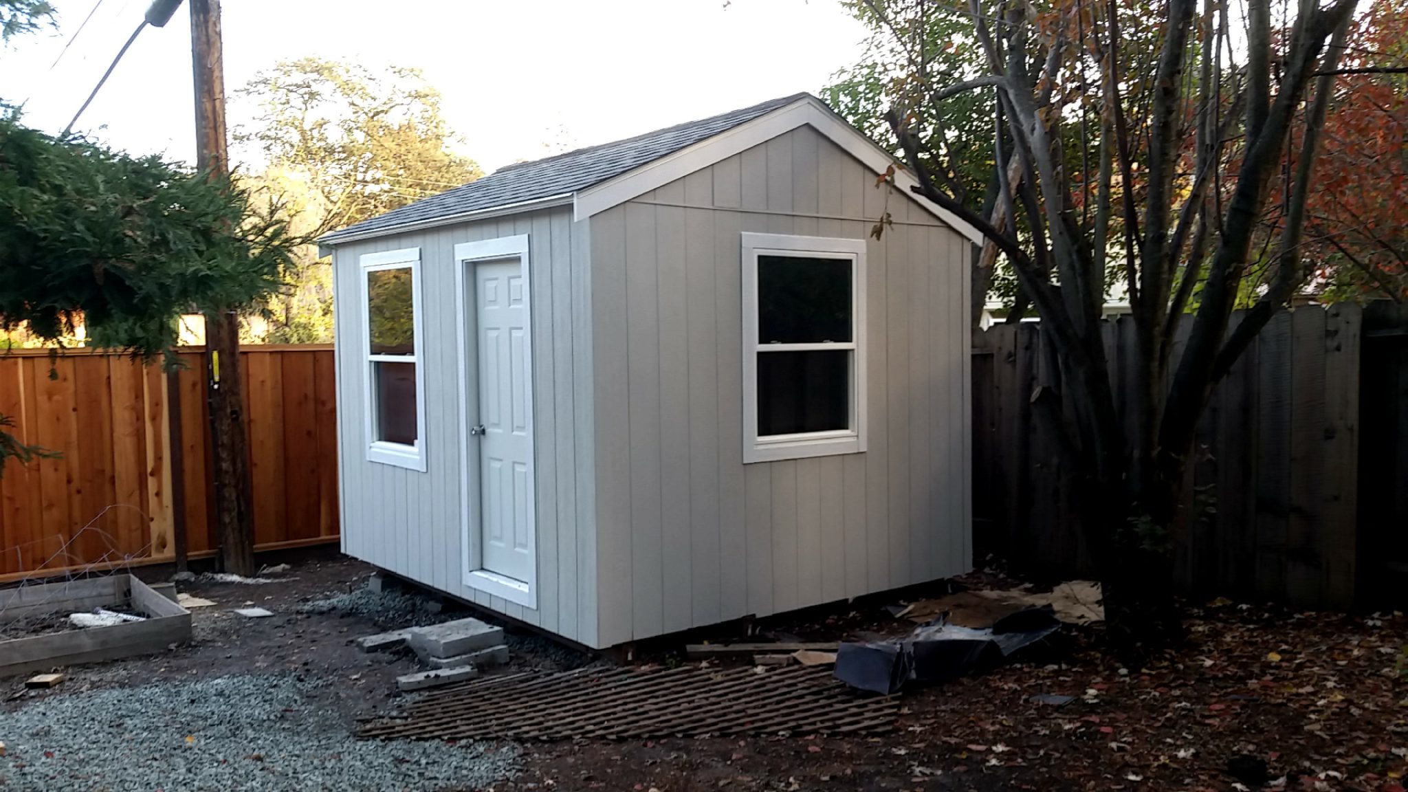
Even though this project has spanned many weekends, it has been an adventure so I feel it fitting to document here.
After living in our house for over 20 years I am finally getting shed/shop where I can tinker around.
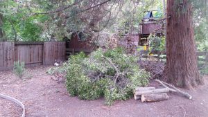
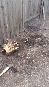
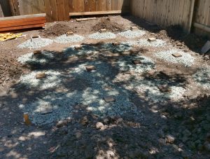
Ground breaking started in April when Bob helped me remove a privet tree near the SE corner of the back yard. Which took about a day or so plus another day or so to remove the stump.
Tree Removal – April 2017
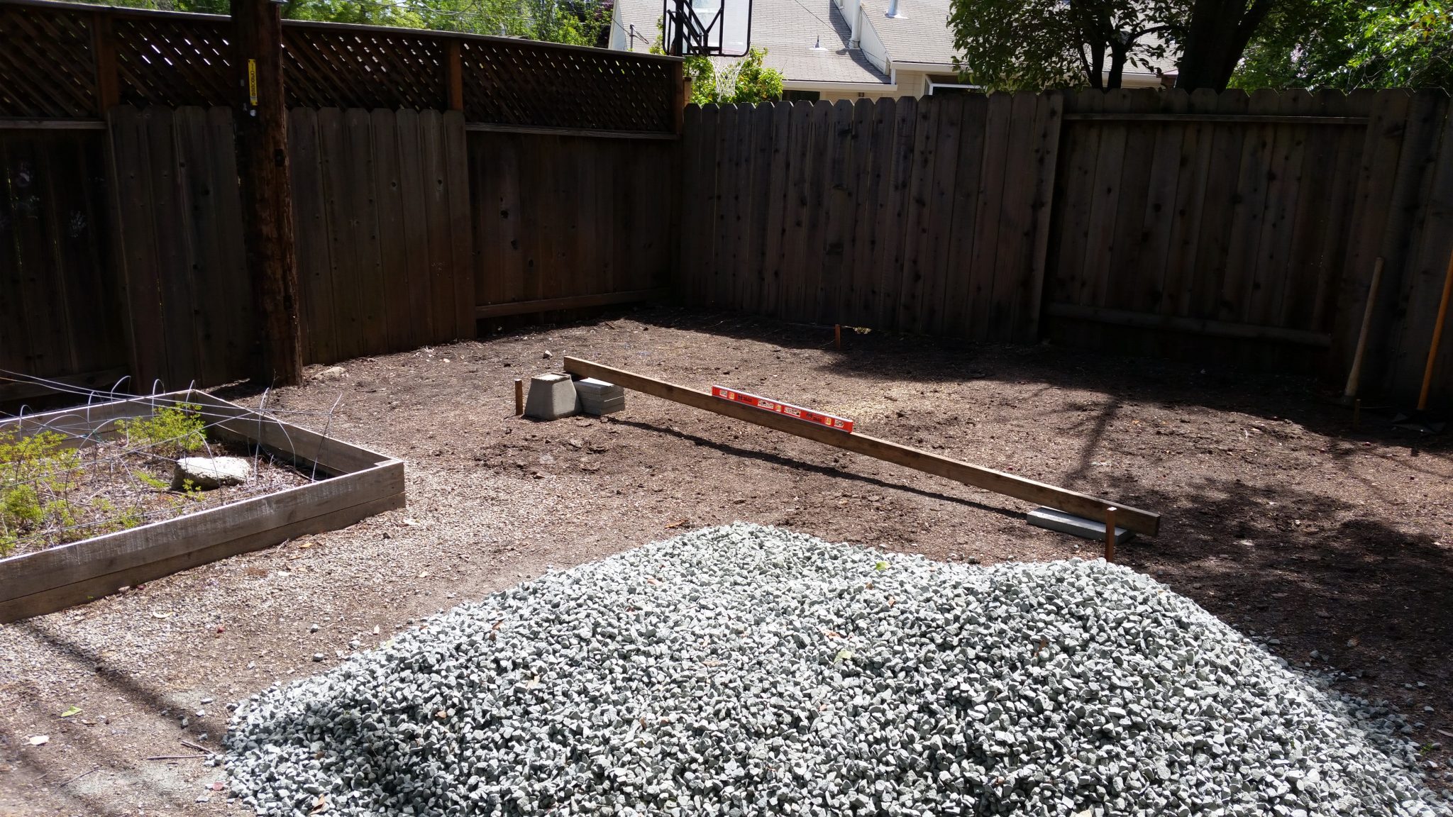
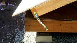
There is a power pole near the corner so I did a bit of easement research and called PG&E to see how close I could build the shed to the pole. Surprisingly the rules were rather vague..so because I had plenty of space, and I could use the space between the shed and the fence for kayak storage, I decided to place it 6 feet from the pole.
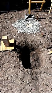
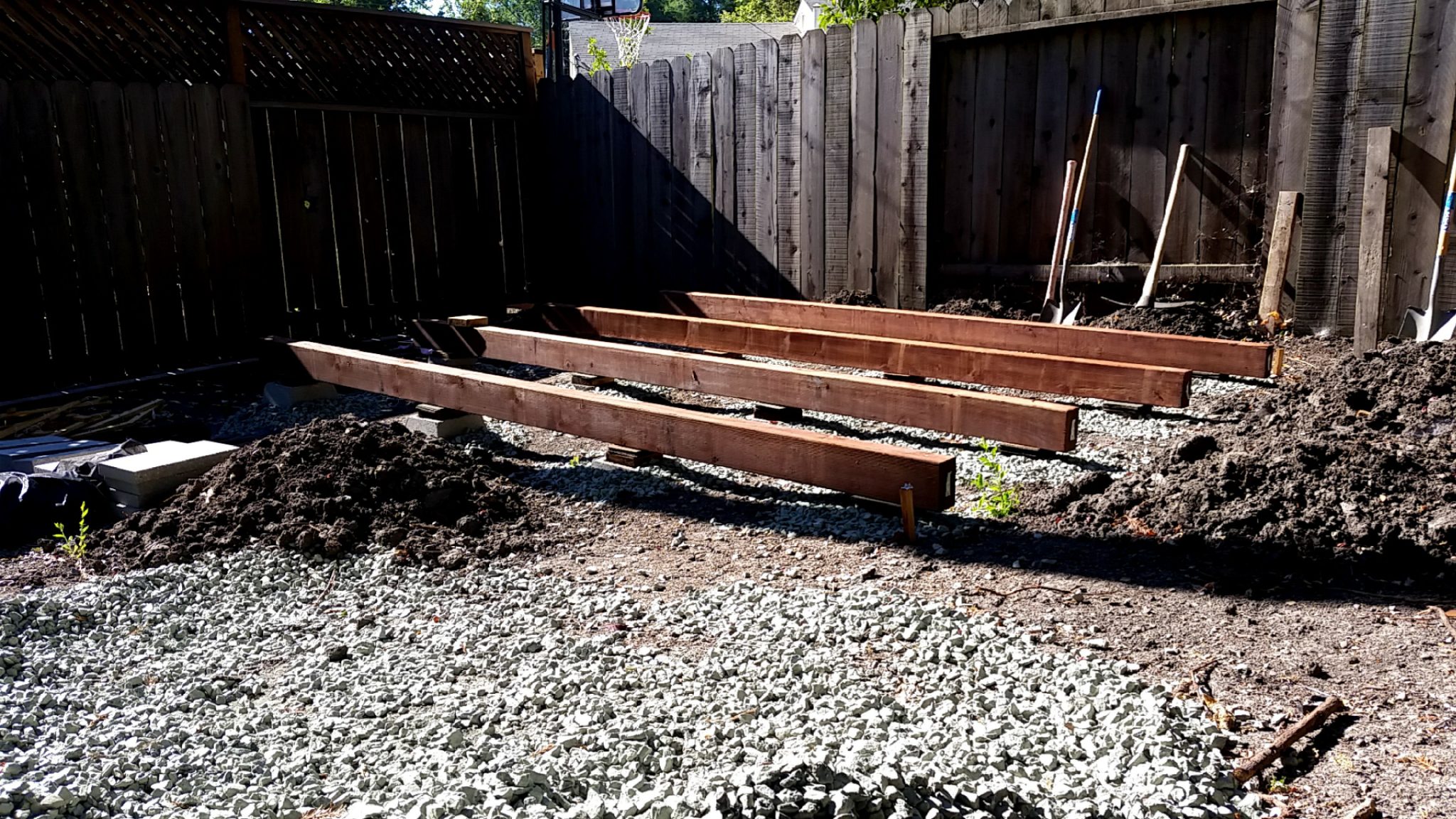
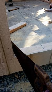
Next step was to get some plans, which, also surprisingly, is not as easy as one would expect to pull off the internet. I settled for a set from cheapsheds.com, which i used as a general guide but ended up modifying the design as i went – primarily by adding a double top plate and associated adjustments related to that. For the foundation, Chris convinced me to go with four 4×6 12-foot pressure treated beams for the “skids”. I installed 4 pier blocks for each skid. The ground in my build site slopes about a foot from West to East so I had to bury the blocks to varying depths in order for their tops to be level. I had 2 yards of angular gravel delivered (which I moved via wheelbarrow to the back yard).
Approximately 1-foot drop from west to east
Using stakes and string I marked off the location. The strings could slide along horizontal members allowing the intersection to me moved in order to adjust the exact location of the corner. Using a tape measure it is possible to make the area square by ensuring the diagonal corner to corner measurements are the same for both diagonals.
Adjustable strings used to square off the building site.
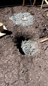
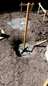
Next step was to install the 16 pier blocks used to support the skids. For each a dug a hole up to 2.5 feet deep, filled the bottom 4+ inches with gravel, placed the block and filled the remaining void with gravel. During this process I used a homemade model of a pier block made of wood so I could easily check to see if the hoke was large enough and the top of the block was level with surrounding blocks. I did my best to level each block with its neighbors. The site slopes approximately 1 foot west to east, so some of the blocks were nearly completely buried while others were nearly resting at surface level. (Mid-May)
June 2nd – All Pier Blocks installed
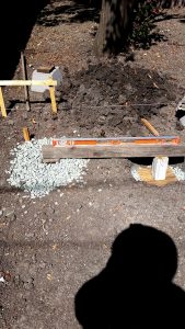
Then I placed the skids and leveled them with cut pieces of asphalt shingles and then screwed the beams to the blocks. In hindsight I should have added wood spacers where the gap was over an inch in order to provide better purchase for the screws…but hey, it only a shed.
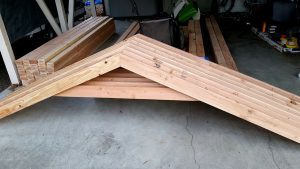
4×6 by 12′ “Skids” – June 18
Because I stored the skids for over a month before using them, one was allowed to twist beyond use – it corkscrewed in quite a fashion. To replace it I screwed 2 2×6’s together, which was slightly cheaper and possibly less susceptible to twisting – I see many people suggesting putting a sheet of plywood inbetween. Also, all of the skids were slightly longer than 12 feet bit I did not trim them because I did not want to cut off the pressure treated end.
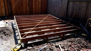
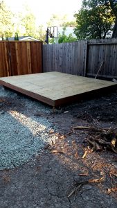
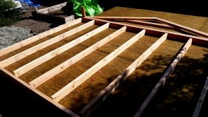
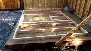
Next up was to install the 2×6 floor joists. Each was exactly 10 feet long so I did not need to cut them. These were also pressure treated. I screwed each into the skids at every contact and also attached the rim joists – which overhang the outside skids by about 7 inches. I used 3″ screws rated for PT wood. I checked for square using the corner to corner tape method (e.g. the diagonal legs should be equal), adjust via sledge hammer before securing the 2×6 to the 4x6s. Note: I took July off to go camping with my family and backpacking with Bob.
Square it up! – Aug 26th
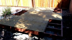
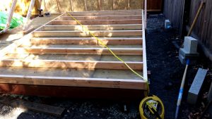
Next up was 3/4″ pressure treated plywood. Attached to the joists with 2.5″ screws. I had to cut one sheet into 2′ x 4′ sections using my skill saw and a a 2×4 guide that I clamped onto the plywood…turned out better than expected.
3/4″ Pressure Treated Plywood Flooring
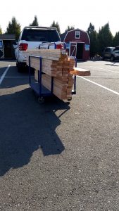
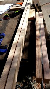
With the floor complete I went to Lowe’s to get most of the framing lumber.
Lumber Run! Sept 15
Parked my mower on top of the siding to keep it from warping.
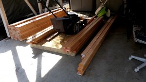
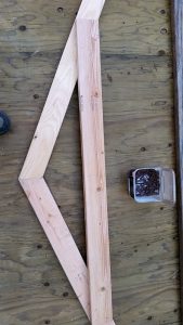
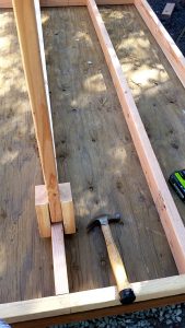
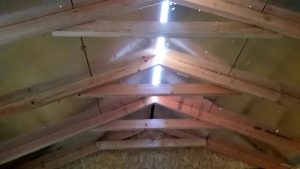
Next up: the truss’s
Truss “Jig” built on the shed floor.
Next up, the window-less/door-less walls:
Measure Corner to Corner – Diagonals should be equal if “square”
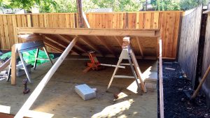
Raised via floor jack and then lifted each side to slip in a 2×4 – then Bob helped lift into place!
A bit of plumbers tape to stop the wall from sliding off during the lift…great idea! Also, note how the siding over hangs the joist.
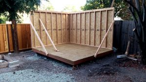
Two walls up! Sept 24
Handy tool for straightening 2x4s when framing the walls
Next up, the walls with windows/doors. A “speed square” is a very handy tool for this stage.
Marking the top and bottom plates. Also shown is the header, which is two 2x4s with a piece of siding in-between.
King, Jack and Cripple stud markings on top and bottom plates. (course the cripple is not needed on the top plate)
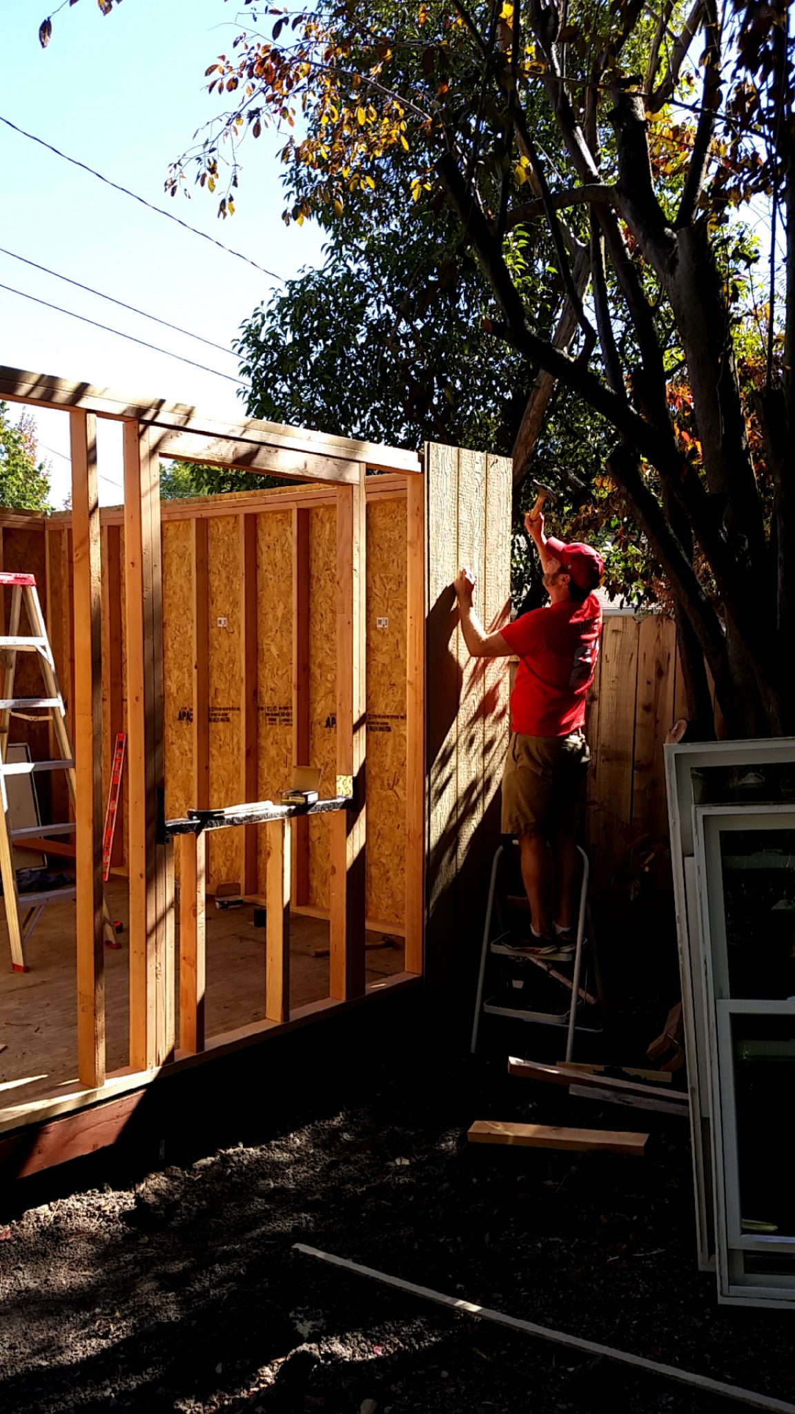
The last wall can’t be sheeted when lying down.
Hanging the sheeting after the wall is up is MUCH harder than doing it while laying flat. Thanks Dan!
Window and Door holes cut out with a router – via the outside so the router bit could rest on the framing for a perfect cut.
Cut the bottom plate for the door.
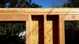
Double top plate – to help tie the two walls together (not shown). Also shown is the jack and king studs for the Header.
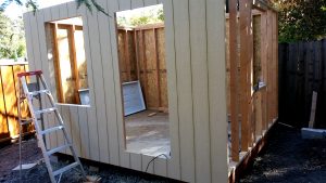
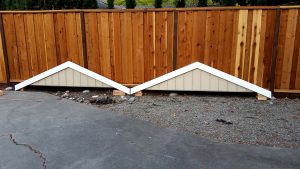
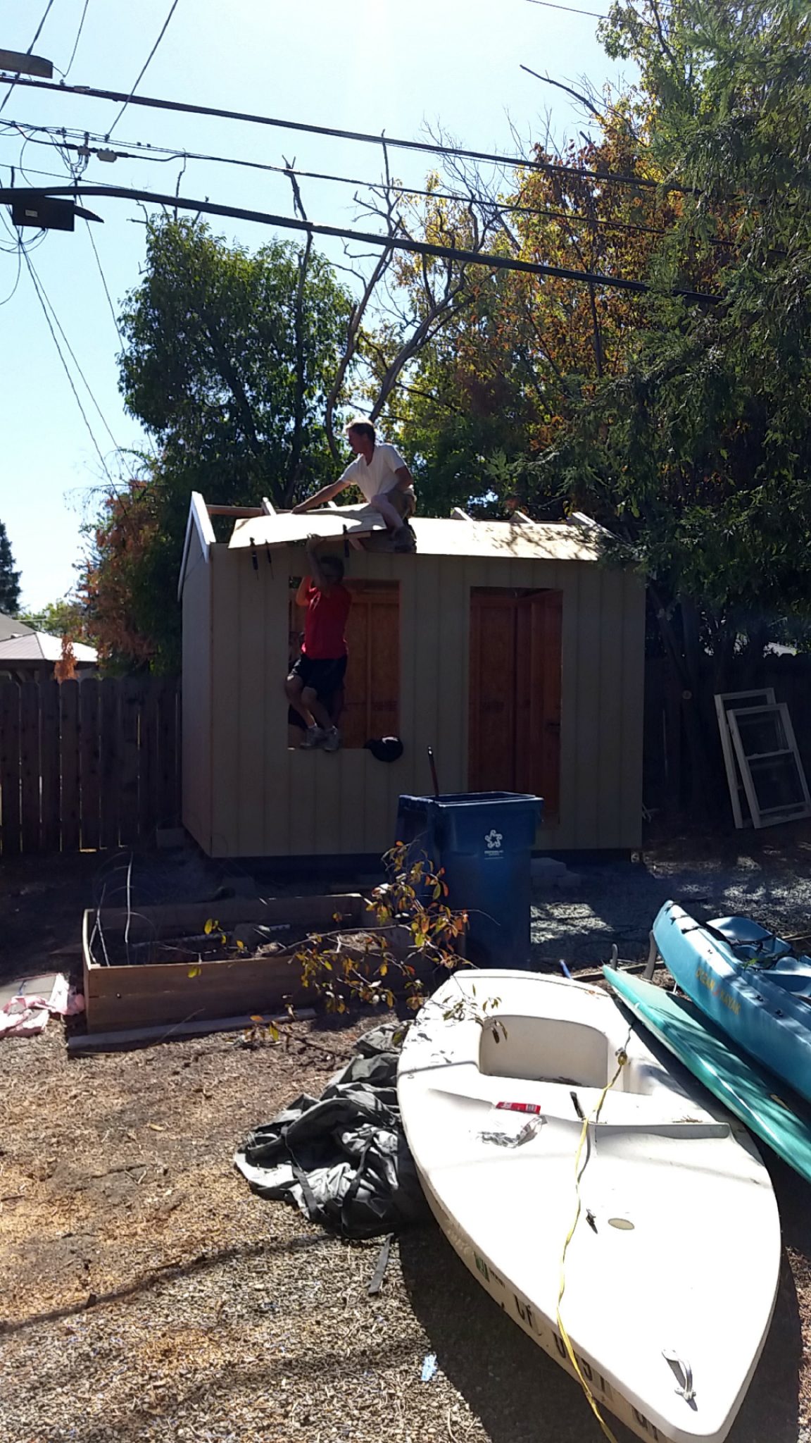
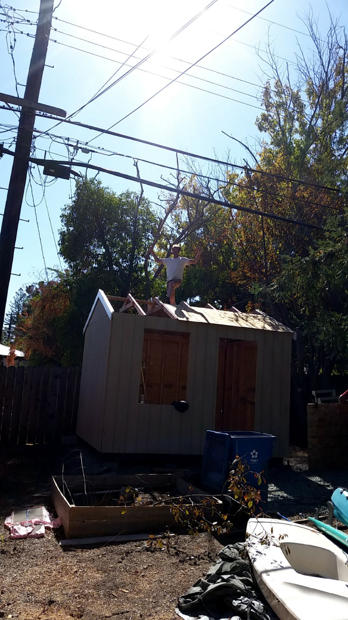
Gable Ends – Pre-Trimmed (Oct 11)
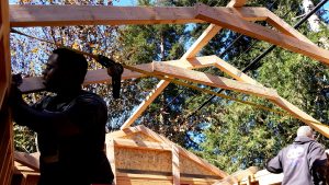
Truss Time! Note the truckers strap used to plumb the side walls a bit. Thanks Keith and Alex!
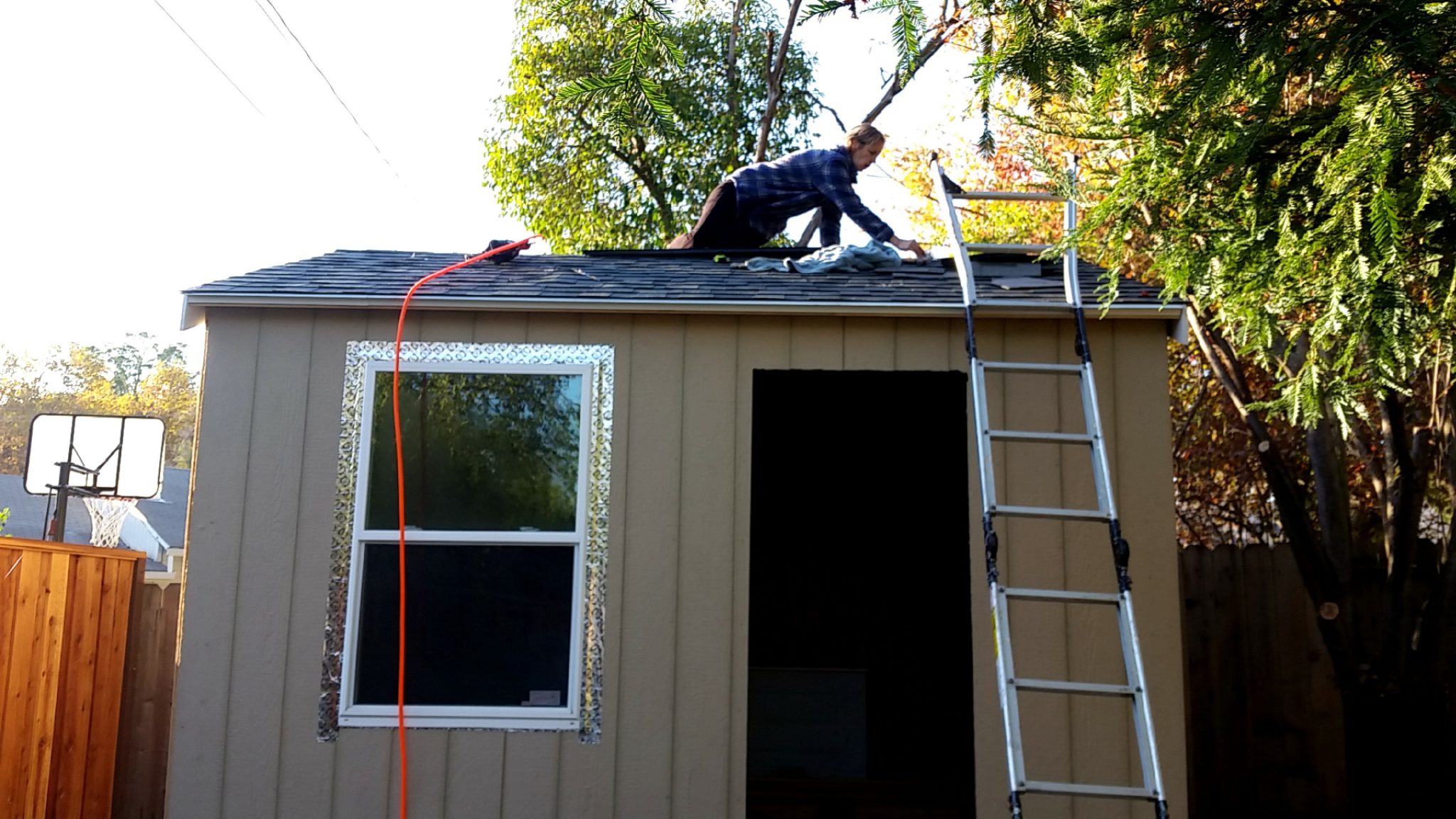
Placing the TechShield sheeting – Roof Time!
Thanks Bob!
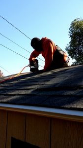
Front Shingles. Thanks Keith!
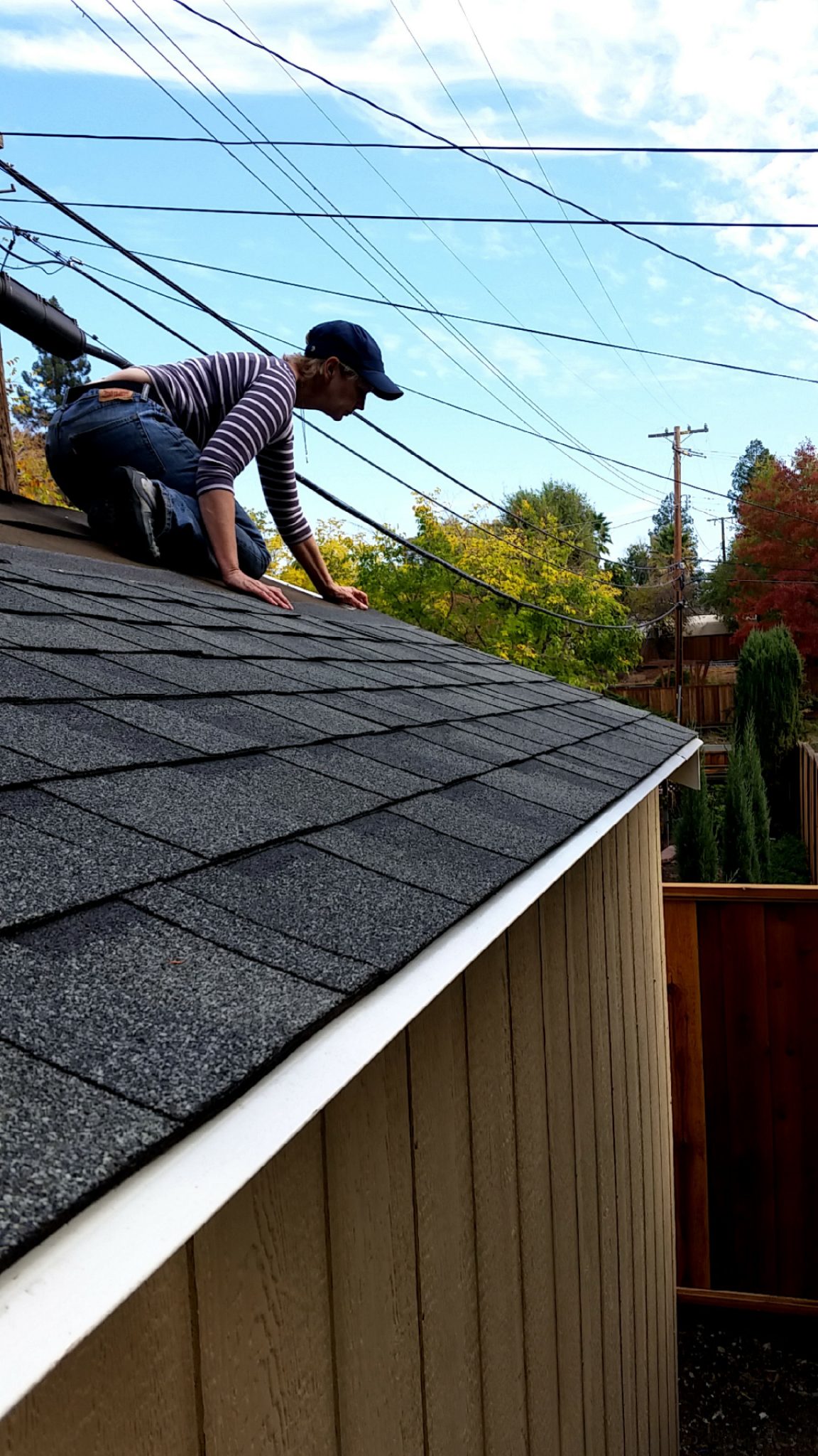
Back Shingles. Thanks Lesley!
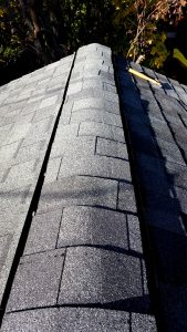
Gap for the ridge vent. Can also see the sheeting spacers.
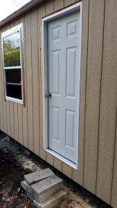
Door In – Nov 4th
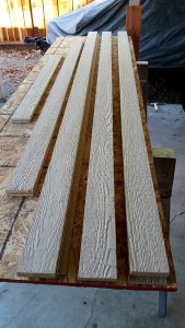
Siding “ripped” into strips to use as trim. (much cheaper)
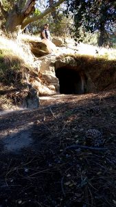
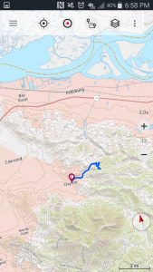
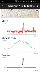
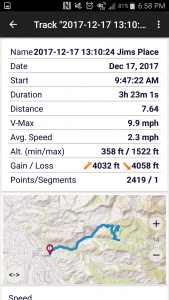
Bill and I set out for Jim’s Place in Black Diamond Mines Regional Park. The area was once an active coal mine and company town. Jim’s Place is an historic miners dwelling carved out sandstone..a cave if you will, with a pretty large doorway, chimney vent, and built in shelf. Something akin to structures I dreamt about building in my youth.
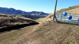
We started at the parking lot off Clayton Road and then headed up what Bill calls “2-mile road” – which is a dirt road used by ranchers, park district vehicle, mt bikers and hikers.
A View from 2-Mile Rd
We were passed by a couple groups of bikers, some of whom started on the Antioch side, went up and over to Clayton, and then back again. This brought back memories for Bill and I as we once regularly road our bikes in these hills. But now we are happy that we are both fit enough to pull off a 8 miler on short notice.
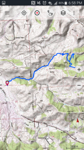
At the top of the road we went through the side gate to continue along the Briones/Diablo trail, up hill, and eventually got up to the power towers….a visible landmark for many miles.
2-Mile Rd is part of many Trails
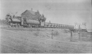
On the way up Bill talked about how the main road used to be open to the public and one could drive from Clayton to Pittsburgh ..and prior to that parts of it used to be a railroad that his great granddad worked on.
Antioch Coal Whatf, circa 1881
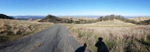
After enjoying view from our highest spot, we decided to head back down the way we came and correct a wrong turn we made to get to Jims.
High Point View
Once we got to old shelter I barely recognized it, a pine in front had grown tremendously since I was last there (at least 15 years ago), obscuring the view, making feel somewhat mysterious.
From there we headed back the way we came. A pleasant day with good conversation and memories.
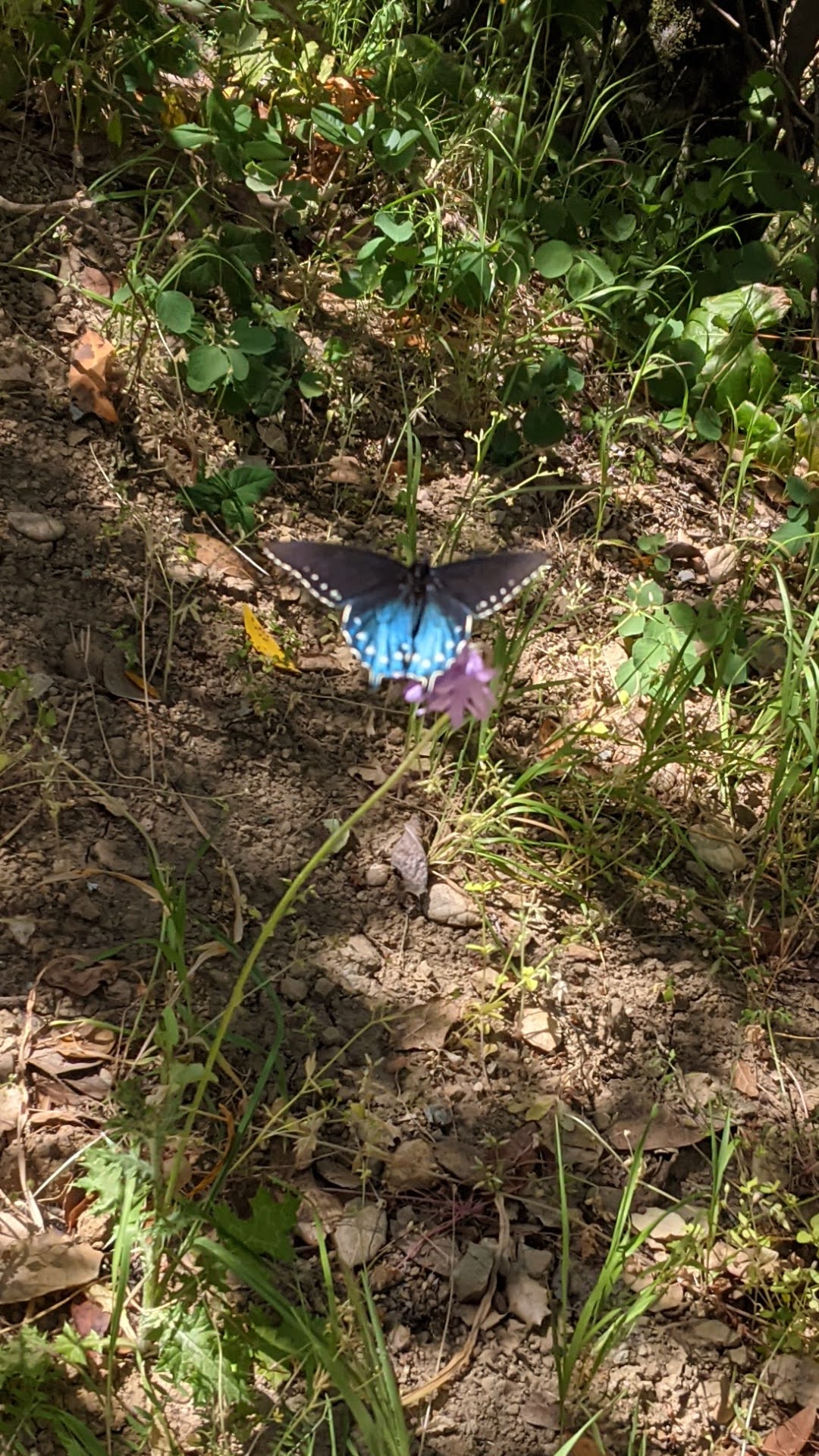
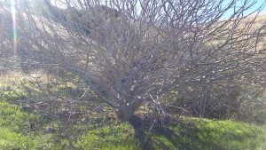
A poor picture of a magnificent Buckeye…branch tips are starting to bud.
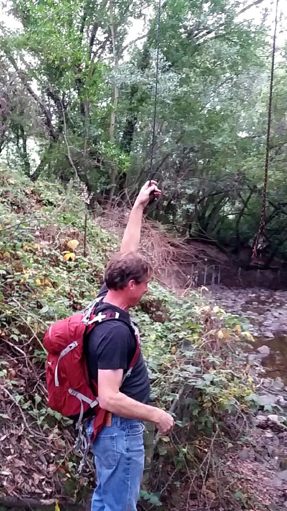
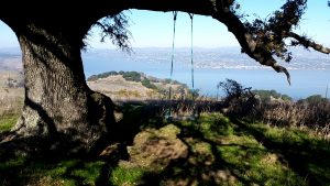
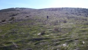
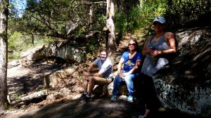
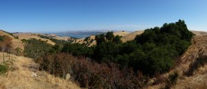
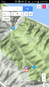
Bob and I set out again today to find a rope swing that we observed at a distance back in May. After failing to find it last time we employed some geo location tech by getting the date of the observance from a FB post (which I must admit I miss a little but not enough to jump back in), then we pulled up pics from that day and tapped into the gps location data to pin point where we were. First time I’ve done that and was happy to see the location data still existed even on the cloud backup of the pic as the original had long since been removed from my phone due to space limitations. Pressing the information icon when viewing the photo on Cameringo+ brought it up on a map. (Note to self-see if the location data lives on the pics in this post..looks like it is an option on upload).
With that info in hand it became an easy task to find the swing, in what I must say is in a rather obvious location- a solo Oak atop a knoll with a sweeping view of Carquinez Straights.
We started the hike at Cementry Lot around 10am, through the main gate and up the left trail into a steep dark hallow. Bob did want to follow a pretry hiker and her dog that took the other path.
It hadent rained in a while so the ground was slightly tacky..the air was cold…night air lingering in the canyon protected by the thick canopy.
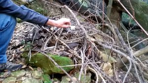
On our way up the steep trail we explored a large oak that had fallen over. We scrambled up the slope, away from the trail to check out the exposed root ball. On the way back down we spotted a critter den under some rocks. The den was large enough for a racoon sized animal. Bob found a small skull on top indicating a carnivore may live there.
Skull atop animal den
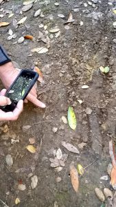
This is near the tracks we saw a few trips back..possible cougar tracks (which we confirmed are still there) …and indeed we saw similar track marks near the base of the den…but truth be told these could have also been made by a hikers dog.
Possible cougar tracks
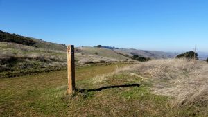
After we cleared the canopy and attained the ridge we took a right and headed to Vista Bench. From there Bob spotted the swing in a distant oak. We saw someone was already there so we hung at the bench for awhile.
Swing Tree via Vista Bench
Then we decided to head cross country to the swing. The hiking was easy since the grass was dead and toppled over, with the green starts of the next crop peeping out a couple of inches. The poison oak had lost its leaves..just clumps of twigs one needs to be cautious of.
Cross Country
We met a fellow hiker at the tree. He had come from Pittsburg and left his wife in town while he hiked to the swing. After talking for a bit he pointed to something in a burl hole that turned out to be a geo cache. He then left to meet his wife for brunch.
The swing appears to have been placed by a sailer….marine rope with some creative bowline knots. The view from the swing is great, but it is more of a leasurly affair as the overall length is not great. Allthough Bob did manage some creative moves. For more of a wild ride one must go to the swing by the windmill, a mile or so south.
It was the shortest hike we have done in a long time, but a memerable one.
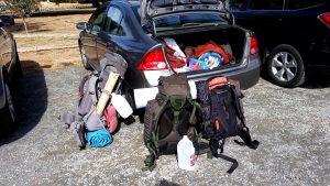
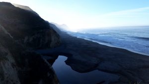
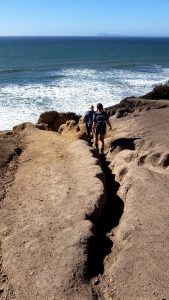
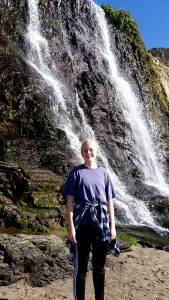
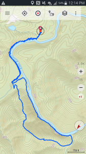
Two wonderful nights spent in this coastal sanctuary (Oct 20-22, 2017) . Wildcat Beach is roughly two miles long and is only accessible via foot, horse, or bike (unless you are working the the National Park Service). One of few tidal falls in the world exist on the southern end.
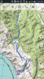
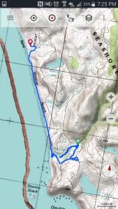
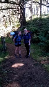
We hiked in from the Bear Valley Visitor Center – approximately 6.5 miles through a variety of micro climates.
The first half of the hike was along the Bear Valley Trail – which is easy walking, mostly along a fern banked creek. The second half was mostly along the Glen Camp Trail, which is single track and a fair bit of climbing until it joined the descending Stewart Trail.
I was fortunate enough to book one of the bluff sites a few months ago during an occasional availability check..it must have been a recent cancellation because it was not available when I checked previously.
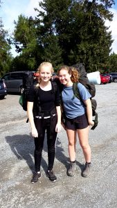
Once the camp was visible, I pointed out our site to the girls and they rushed ahead and beat me to it.
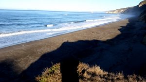
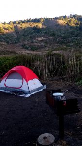
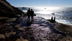
We left the car around 1:50pm on Friday..and got to the site around 4:30. The first thing we did was drop the packs and head to the bluff. Situated roughly in the center of the beach it offers a magnificent view of the beach and bay, South towards the waterfall (all though it is not visible from here):
North towards Coast Camp, North West towards the Point.
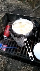
The long rows of waves continually crashing on the beach making a surprisingly loud but very pleasant array of sounds. The Sun was heading towards the horizon so I started boiling some water on my trusty MSR wisperlight while they started setting up their tent.
That night we hydrated a large bag of dried minestrone soup and added a dried bag of Spanish rice (both purchased at a grocery store we hit before leaving town)…a tasty combination. Later we had hot chocolate and xxx cookies.
The sun set while we were cooking so we missed it dropping below the horizon but we were witness to a long show of changing pink clouds as the sunset moved through the different cloud layers.
Later that night Iona thought she saw the Milky Way but I said it was probably a cloud because it was somewhat overcast, however the Galaxy was out in full force Saturday night so she was probably right.
We put all our food and things like deodorant in the food box in order to keep critters out of our tent and we put the rest of the gear in our tents because the condensation was already starting to appear and one could tell things were going to get very wet overnight.
I was pleased to see that that since I was last there they moved the pit toilets and brought in a new source of potable water. The water used to be so mineralized that it tasted horrible and would start clogging your filter when treating it, but now it tastes pretty good…so we didn’t need the powdered gateraid that I carried in.
We woke up to wet tents but our gear was mostly dry. We made breakfast of oatmeal and raisins (and coffee for me), packed lunch supplies in my backpack and headed to the Falls via the beach around 10:45am. Unfortunately I did not write down the tide times and our phones had no service so it was not immediately clear if the tide was coming in or out. We asked a woman on the beach and she said someone told her low tide was at noon, so we headed out along the beach knowing that there is an exit route from the beach to the coast trail at the Falls. But, after getting about half way it became obvious that the tide was coming in and that the beach ahead would soon be impassable, so we turned around. We later confirmed via some Cal coeds that noon was the high tide (11:30am the day prior).
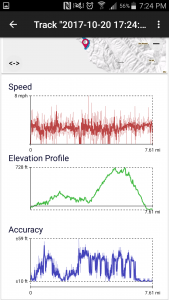
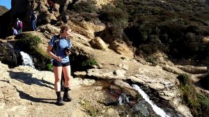
We headed back to Wildacat camp so we could pick up the coast trail and we headed out again. A pleasant trail in bluff scrub. After a bit we came to a fantastic Vista and several other people including some of our camp neighbors were enjoying the view and lively conversation. We continued on until the trail crossed the creek that feeds the Falls so I decided to start recording or track and follow the marginal trail that followed the creek.
The main trail continues past the creek and there is no official trail to the beach but I knew it was possible to get there. However after going about 2/3 of the way the brambles and poison oak turned us back – but the girls did get to experience some honest bushwacking. Once we got back to the main trail, and did a bit of poison oak decon we decided to make lunch: flour tortillas with hummas, tomato, avacado and cheese…very yummy.
Several hikers, starting from the southern Palomarin entrance, came by asking if this was the trail to the beach and we said no, others said they going to the Falls via wildcat camp, but then two woman came by saying they heard that there was a path marked by a rock arrow and if they did not come back this way then they found it. So after lunch and they did not return, the girls set out to find it and I soon followed. We were quite excited when we found it! The prospect of going back to camp and then out to the Falls via the beach was not favorable.
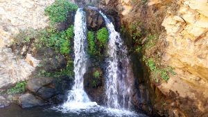
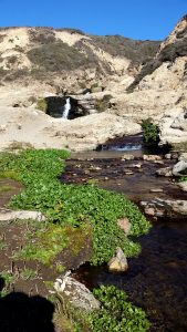
The side trail to the Falls was a bit narrow in spots but a virtual freeway compared to the failed creek route. It drops down to a very cool rocky area where the creek forms several mini falls and pools…a special spot with many happy people taking it all in. One of the mini falls looks like a scale model version of the world renowned Burney Falls.
After scrambling down the gully to the beach we hung out at the base of the Falls with the other hikers for a bit, one of whom was playing a large piece of sea weed as a trumpet…remarkedly well.
By this time it was getting near low tide so we headed back to camp along the beach and made pasta with pesto for dinner. A group of boy scouts arrived and had set up camp. I spoke with another group of campers and they had packed in oysters the night before and some of their members went back to the car that day to resupply!
The stars that night were fantastic and the new moon was the thinest of slivers, with the orb outline slightly visible. One could imaging the Sun pointing up to it and lighting just that side.
We saw a fox for the second night in a row as he came around to inspect camp. And we enjoyed watching a gopher drag large branchs done his hole into his leir.
The next morning we had breakfast, while the tents dried, and slowly broke camp. We hit the trail around 10:50am and made great time to the car. We stopped for a milk shake in Fairfax and were home around 3:30pm.
A great trip. I am so happy my daughter and her friend wanted to go! The weather was fantastic and we just missed the first rain of the season by a day (before we arrived).
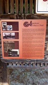
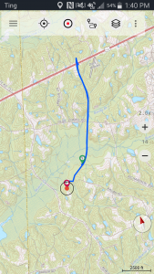
Rachelle, Paul, Dan and I did a 5+ mile out and back walk on the American Tobacco Trail, a rails to trails conversion that passes right by Rachelle’s and Paul’s house.
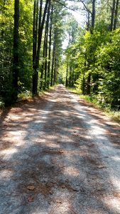
We drove to the end, mile marker 22 and hiked just over 2.5 miles along a lovely tree lined gravel road.
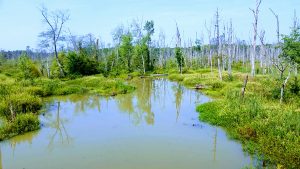
The trail is a popular family bike destintion and we passed a horse and rider while on the bridge crossing over dead tree swamp.
Paul found a few golf balls next too the driving range and Dan pointed out some poison ivy – which to me looked a lot like poison oak.
Numerous turtles were sunning themselves in the swamp.
The weather was in the mid to high 70s with humidity around 40%. All in all a very pleasant experience.
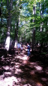
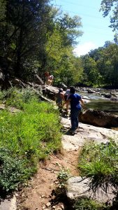
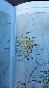
Today Dan, Rachelle, Silvia and I went for a nice 3.6 mile hike along the Eno River.
The trail dropped gently from the parking lot down to the River at a place called Fews Ford. Several people, mostly kids, were wadding in the water.
We followed the trail up river, along the bank – which involed the occasional scramble but in general was an easy walk. At our first junction we had the option of crossing a foot bridge over a tributary that connected to the 2.6 mile Holden Mill Trail loop. We went counter clockwise which immediately started climbing up at a moderate angle, then some small rolls along the top and gently decended back down to the river, which we followed back to the bridge – passing several cool outcrops the went gently into th water and had been worn smooth. These outcrops provided great places to picnic or rest.
There were several other hikers, all very friendly, and many with dogs.
Dan spotted the most wildliunfe, turtles, a tree frog, a salemander, spider webs. There were several places were bugs were making a load noise in the trees (cicada?)
Observations: numerous turkey vultures, barn swallows, a bee hive, several types of butterflies, a pretty decent wind and flood tide that a sailboat was utilizing nicely.
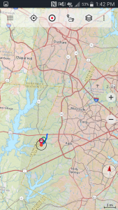
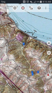
Today Bob and I set out with a loose plan to find a rope swing we once spotted on a distant ridge. We parked the car near the turn off to the Navy Ozol Defense Fuel Support Point, not very far from where the road is stopped to motorized traffic.
This trailhead does not have an official parking lot but one can always find a place to park.
Just inside the gate there are two groundwater monitoring wells related to the Ozol facility that we think were were installed by Groundwater Technologies, Inc (GTI) where we both worked as geologists back in the day. These wells are located in a flat bit at the base of two canyons, where Bob said a landslide occurred about a decade ago.
After a brief stint up the trail there is a junction where the left fork gets steep quickly on its way to the Ridge and several view spots, while the right fork continues lazily up the valley. We went right hoping we would be able to spot the rope swing from below.
The temperature hovered around 100 the day before so we got a fairly early start and the walking temperature was perfect while we strolled up the tree lined valley. A float plane traveled overhead…loud and slow..which promoted the first appearance of the binoculars and some stories of similar planes we both traveled in during separate trips to Alaska.
At the head of the valley, where the trail starts to get steep we stopped for a rest and noticed a pretry large bee hive in the base of an old oak. While conversing here Bob noticed on one of his map layers in his topo app, that there was a marked trail taking off to the right and appeared to loop back to the wells. We could see what used to be a road but it was long over grown. We decided to take this route – a new path afterall. The interesting thing is that it was not on any of my map overlays…as if were scrubbed. Once we got past the large oaks obscuring the entrance we could see the old road quite clearly as it paralleled a dry creek working it’s way sharply up the slope. It was covered with several inches of duff and obviously had not been used for some time. It abroubtly ended and some down trees and a 90 degree corner of a brand new, well constructed, barbed wire fence. None of our maps showed a property boundary here, but later I found one shown on Google Maps. At the time we speculated that is was part of the land swap deal.
We bushwacked parallel to the fence up to the ridge, took some pictures, did a bit of bird watching and eventually got to a point that we could not readily proceed without crossing the fence…which was not an appealing idea, so we headed back the way we came.