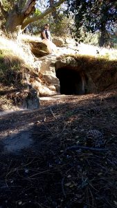
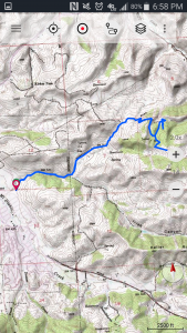
Bill and I set out for Jim’s Place in Black Diamond Mines Regional Park. The area was once an active coal mine and company town. Jim’s Place is an historic miners dwelling carved out sandstone..a cave if you will, with a pretty large doorway, chimney vent, and built in shelf. Something akin to structures I dreamt about building in my youth.
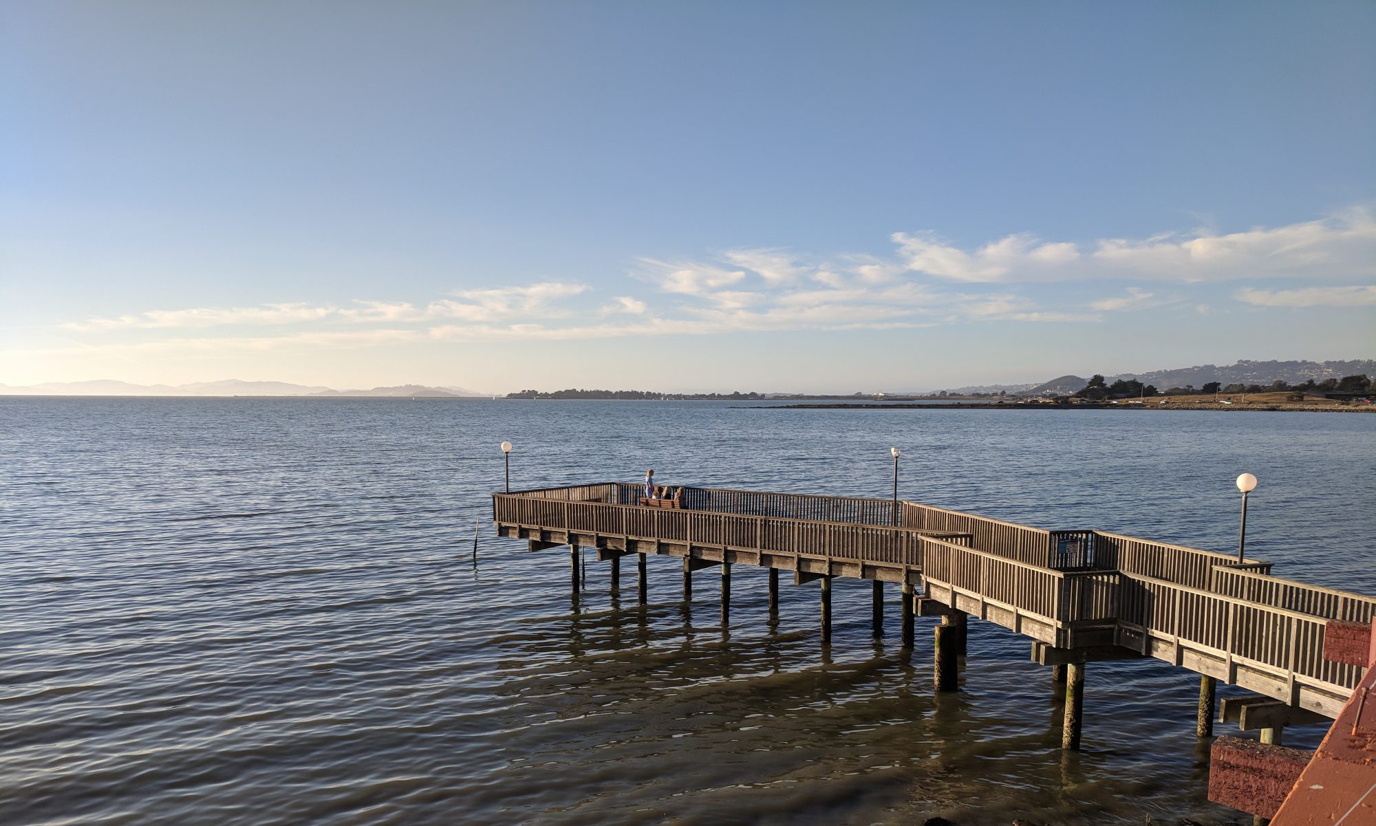
We started at the parking lot off Clayton Road and then headed up what Bill calls “2-mile road” – which is a dirt road used by ranchers, park district vehicle, mt bikers and hikers.
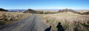
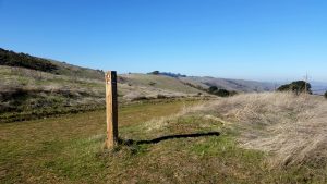
A View from 2-Mile Rd
We were passed by a couple groups of bikers, some of whom started on the Antioch side, went up and over to Clayton, and then back again. This brought back memories for Bill and I as we once regularly road our bikes in these hills. But now we are happy that we are both fit enough to pull off a 8 miler on short notice.
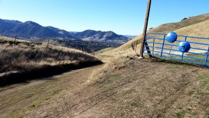
At the top of the road we went through the side gate to continue along the Briones/Diablo trail, up hill, and eventually got up to the power towers….a visible landmark for many miles.
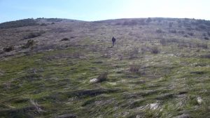
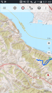
2-Mile Rd is part of many Trails
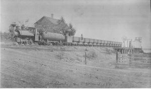
On the way up Bill talked about how the main road used to be open to the public and one could drive from Clayton to Pittsburgh ..and prior to that parts of it used to be a railroad that his great granddad worked on.
Antioch Coal Whatf, circa 1881
After enjoying view from our highest spot, we decided to head back down the way we came and correct a wrong turn we made to get to Jims.
High Point View
Once we got to old shelter I barely recognized it, a pine in front had grown tremendously since I was last there (at least 15 years ago), obscuring the view, making feel somewhat mysterious.
From there we headed back the way we came. A pleasant day with good conversation and memories.
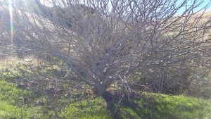
A poor picture of a magnificent Buckeye…branch tips are starting to bud.
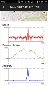
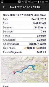
Bob and I set out again today to find a rope swing that we observed at a distance back in May. After failing to find it last time we employed some geo location tech by getting the date of the observance from a FB post (which I must admit I miss a little but not enough to jump back in), then we pulled up pics from that day and tapped into the gps location data to pin point where we were. First time I’ve done that and was happy to see the location data still existed even on the cloud backup of the pic as the original had long since been removed from my phone due to space limitations. Pressing the information icon when viewing the photo on Cameringo+ brought it up on a map. (Note to self-see if the location data lives on the pics in this post..looks like it is an option on upload).
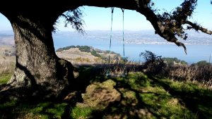
With that info in hand it became an easy task to find the swing, in what I must say is in a rather obvious location- a solo Oak atop a knoll with a sweeping view of Carquinez Straights.
We started the hike at Cementry Lot around 10am, through the main gate and up the left trail into a steep dark hallow. Bob did want to follow a pretry hiker and her dog that took the other path.
It hadent rained in a while so the ground was slightly tacky..the air was cold…night air lingering in the canyon protected by the thick canopy.
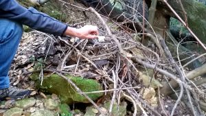
On our way up the steep trail we explored a large oak that had fallen over. We scrambled up the slope, away from the trail to check out the exposed root ball. On the way back down we spotted a critter den under some rocks. The den was large enough for a racoon sized animal. Bob found a small skull on top indicating a carnivore may live there.
Skull atop animal den
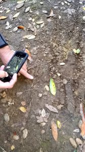
This is near the tracks we saw a few trips back..possible cougar tracks (which we confirmed are still there) …and indeed we saw similar track marks near the base of the den…but truth be told these could have also been made by a hikers dog.
Possible cougar tracks
After we cleared the canopy and attained the ridge we took a right and headed to Vista Bench. From there Bob spotted the swing in a distant oak. We saw someone was already there so we hung at the bench for awhile.
Swing Tree via Vista Bench
Then we decided to head cross country to the swing. The hiking was easy since the grass was dead and toppled over, with the green starts of the next crop peeping out a couple of inches. The poison oak had lost its leaves..just clumps of twigs one needs to be cautious of.
Cross Country
We met a fellow hiker at the tree. He had come from Pittsburg and left his wife in town while he hiked to the swing. After talking for a bit he pointed to something in a burl hole that turned out to be a geo cache. He then left to meet his wife for brunch.
The swing appears to have been placed by a sailer….marine rope with some creative bowline knots. The view from the swing is great, but it is more of a leasurly affair as the overall length is not great. Allthough Bob did manage some creative moves. For more of a wild ride one must go to the swing by the windmill, a mile or so south.
It was the shortest hike we have done in a long time, but a memerable one.