Overall Rating: B+
Observations: numerous turkey vultures, barn swallows, a bee hive, several types of butterflies, a pretty decent wind and flood tide that a sailboat was utilizing nicely.
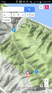
Today Bob and I set out with a loose plan to find a rope swing we once spotted on a distant ridge. We parked the car near the turn off to the Navy Ozol Defense Fuel Support Point, not very far from where the road is stopped to motorized traffic.
This trailhead does not have an official parking lot but one can always find a place to park.
Just inside the gate there are two groundwater monitoring wells related to the Ozol facility that we think were were installed by Groundwater Technologies, Inc (GTI) where we both worked as geologists back in the day. These wells are located in a flat bit at the base of two canyons, where Bob said a landslide occurred about a decade ago.
After a brief stint up the trail there is a junction where the left fork gets steep quickly on its way to the Ridge and several view spots, while the right fork continues lazily up the valley. We went right hoping we would be able to spot the rope swing from below.
The temperature hovered around 100 the day before so we got a fairly early start and the walking temperature was perfect while we strolled up the tree lined valley. A float plane traveled overhead…loud and slow..which promoted the first appearance of the binoculars and some stories of similar planes we both traveled in during separate trips to Alaska.
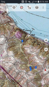
At the head of the valley, where the trail starts to get steep we stopped for a rest and noticed a pretry large bee hive in the base of an old oak. While conversing here Bob noticed on one of his map layers in his topo app, that there was a marked trail taking off to the right and appeared to loop back to the wells. We could see what used to be a road but it was long over grown. We decided to take this route – a new path afterall. The interesting thing is that it was not on any of my map overlays…as if were scrubbed. Once we got past the large oaks obscuring the entrance we could see the old road quite clearly as it paralleled a dry creek working it’s way sharply up the slope. It was covered with several inches of duff and obviously had not been used for some time. It abroubtly ended and some down trees and a 90 degree corner of a brand new, well constructed, barbed wire fence. None of our maps showed a property boundary here, but later I found one shown on Google Maps. At the time we speculated that is was part of the land swap deal.
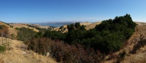
We bushwacked parallel to the fence up to the ridge, took some pictures, did a bit of bird watching and eventually got to a point that we could not readily proceed without crossing the fence…which was not an appealing idea, so we headed back the way we came.